Other Great Local Rides
There is some exceptional riding to be had in the Ohakune area.
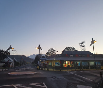
Give us a call or come see us in the shop to discuss the best rides for you and grab some maps / directions or a lift!
Here are some great local examples....Chaaa-hoo!
Ohakune Mountain Rd
Suitable for beginners up. 1-2 hours - good brakes needed! 17kms downhill. 1000m descent. A nice easy ride with amazing alpine views over your shoulder.
This ride takes you from alpine herb fields, through tussock land, alpine forest, then beech forest, then huge podocarp tree forests - a huge variety of vegetation, plus views. It's a completely sealed road from top to bottom.
You can catch a ride to the top and get picked up at the end, to make it all downhill riding. There are great cafe's and pubs to reward you at the bottom of the mountain road, and in Ohakune.
Kaimanawa Alpine Adventures - Heli Biking
For intermediate to Advanced riders 4-5 hours, private downhill 23 km descent - Grade 3
The Kaimanawa Descent is a 23km down hill mountain biking trail, designed to accommodate intermediate to advanced level riders (grade 3). The package begins with a helicopter flight from our base (South Taupō) to the trail head on the Patutu Tops (1673m). The first 15km will see you descend through Kaimanawa alpine tussock country, taking in the spectacular views of the entire Central Plateau and the towering volcanic peaks of the Tongariro National Park. The final 8km twists and turns through New Zealand native mountain beech forest, to finish back at our base on Waipakihi Road.
The total ride descent is just under 2500ft! (800m), With 430m of climbing.
The ride itself takes between three and four hours, allowing plenty of time to stop and soak up the views.
The Kaimanawa Alpine Adventure helicopter transport e-bikes and regular bikes.
Sneak peak preview:
Ratamarie Rd / Ohakune Lakes Scenic Reserve / Rangataua:
For beginner to intermediate riders. 2.5-3.5 hours, a 15km loop from Ohakune.
This is a great ride with awesome mountain views for beginners to learn the golden rules of country riding.
Head out from Ohakune on the Ohakune-Raetihi rd. Turn down Lakes rd on your left. Head down Lakes Rd, and then left again on to Ratamarie (farm track). It's an up and down ride with gates that must be closed after you. Try not to scare the sheep and please don't do this ride during lambing season (September-October) Once the track turns back into a gravel road, you will come to a major intersection where you continue straight (across the State Highway) into Rangataua. Take the last left which is Dreadnaught Rd, which takes you back to Railway Row in Ohakune junction.
Tree Trunk Gorge
For intermediate riders. 2-4 hours; 17kms Grade 3.
Directions: 22kms from Turangi (heading South) on SH1 Desert Rd. The track is sign posted.
This popular ride starts out on the Desert Rd, and follows an old survey track along the side of the upper Tongariro River. Ride across the Tongariro River Bridge (check out the powerful waterfall) and continue another 500 metres.
Turn left at the sign posted "Kaimanawa Rd". This is the start of the Tree Trunk Gorge track. After approx 5kms, there is a picnic area. Continue past the picnic area and turn left at the T intersection.
Make another left turn at the Pillars of Hercules, which is sign posted and is approx 1km from the intersection. There are very steep steps leading down to the Pillars, and most people walk down and carry their bike. From the Pillars you can ride back the way you came, or continue on for a round trip. The alternative round trip takes you along State Highway 1. Be careful, as this road is dangerous due to fast moving traffic and heavy vehicles.
From the Pillars of Hercules, you will cross a bridge and continue until you reach the 4WD tracks. Stay on the main 4WD track until you reach the highway and make a left turn to return to the start of the track.
This track comprises sealed and gravel roads, as well as a good shingle track. Old lava crags and prisitne native bush are the outstanding features on this ride.
John McDonald Loop
For advanced riders only - 4-7 hours.
Park just off the road on State Highway 47 at a picnic area at John McDonald Rd. Cycle Northwest and turn down down the gravel road.
Stay on this track and you will come to a flat area above the Mangatepopo Stream, also known as the Valley of Death.
Go down to the bottom of the stream (you may need to walk) down the steep bank and follow the stream until you come to the ford of the 4WD track. Follow the track West and at the next intersection, turn right down a steep track, over a bridge and until you meet up with the 42 Traverse track. Head SouthWest on the 42 Traverse to the gravel pit turn-off and then head East to the pumice pit. From the pumice pit follow the gravel road back.
Note: For this ride you will need a good map and compass, as there are no signs en-route. A cycle guide is recommended.
Ruatiti Road
Sealed road, very scenic, 16km downhill from SH4 to Ruatiti Domain picnic area and swimming holes.
This is a one-way track and you will need to be picked up.
For the more advanced, you could ride back uphill. The Domain is situated 22km West of the Raetihi-Ohura turnoff on State Highway 4, south of National Park.
Tukino Mountain Road
For advanced riders: 28km 2-4 hours.
The park is just off the Desert Road, on the Tukino Ski field Road.
It's a very simple but quite hard ride with 15km uphill (up 600m) and 15km back down, and some areas are exposed scree.
Follow the 4WD track towards the mountain all the way to the skifield and then back down the same way. The Telecom transmitter is on the way to guide you. There is the option to catch a ride up to the top to enjoy the 15km downhill ride through stretches of scoria and some sandy areas.
This ride provides awesome views of the mountain on a fine day.
Note: Only recommended if you have your own bikes and equipment.
Mangapurua Trig
A challenging 3-5 hour ride over 22km return.
The Mangapurua Trig, down the Ruatiti Valley from Raetihi, is simple to follow and crosses farmland before going into the vast native bush areas of the Whanganui region. At the end of the track is a five minute walk up to the trig, rewarding the rider with spectacular views of the Volcanic Plateau and Mt Taranaki.
Most of the ride is in bush, but there are some views and the ride is excellent. The track is part of the the original route to the Bridge to Nowhere with plenty of challenges.